Building on previous GLPF-funded design work, this team will create an Adaptive Management and Remote Sensing (AMARS) platform, a new tool to help Great Lakes communities restore their coastlines naturally and reduce costs. Rather than hardening coastlines, an expensive strategy that negatively alters sediment movement, this team will combine nature-based solutions with remote sensing and machine learning technology to give communities informed recommendations for coastal restoration and landscape design.
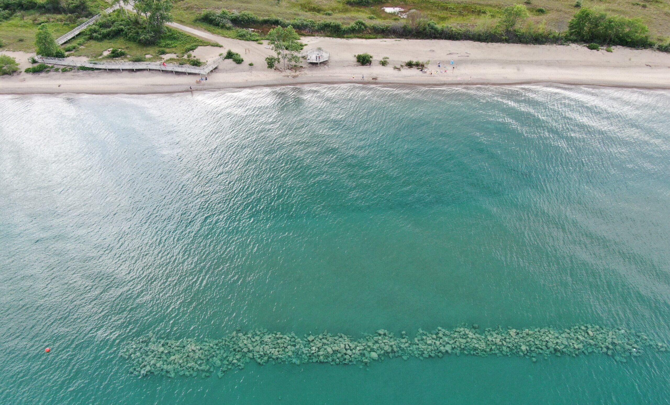
Coastlines are critical habitats and a natural defense to protect communities from flooding. Yet as heavier storms and changing lake levels threaten coasts in new ways, communities face a pivotal choice: either follow the status quo “defend and control” approach, marked by expensive fixed infrastructure projects that harden the coastlines, or pursue a new adaptive management approach that works with natural coastal processes to replenish coastlines rather than starve them. Adaptive management requires regular data on how the coastal dynamics are changing, and guidance on what to do in response. The informational needs can be a hurdle to adaptive management practices. AMARS will address this barrier: the platform will build the information and tools needed to manage their coastlines in a way that works with nature. For example, drone imagery analysis could reveal where a community may strategically create artificial underwater reefs to reduce wave energy or place dredged material to nourish coastlines, rather than stopping wave action with jetties or hardening them with riprap.
The team will pilot AMARS with three partner communities– Wisconsin Point, WI; Sandy Pond, NY; and East Bay, NY.—and convene them regularly to establish a formal AMARS Community of Practice where they will share experiences, solve challenges, and refine deployment strategies. Through tailored local workshops and trainings, municipal staff, public works departments, citizen scientists, and residents will learn how to interpret and apply AMARS data to real-world restoration projects. They will actively engage with regional networks and forums (NOAA, SACE, IAGLR, APWA, and GLRI) to expand awareness and adoption of the AMARS approach for effective coastal management. Ultimately, this project will demonstrate how communities can use consistent data, adaptive management, and beneficial sediment use to restore coastal landscapes, enhance resilience, and integrate nature-based design into permitting and planning processes across the Great Lakes.